Tiruppundi Fm
Type Locality and Naming
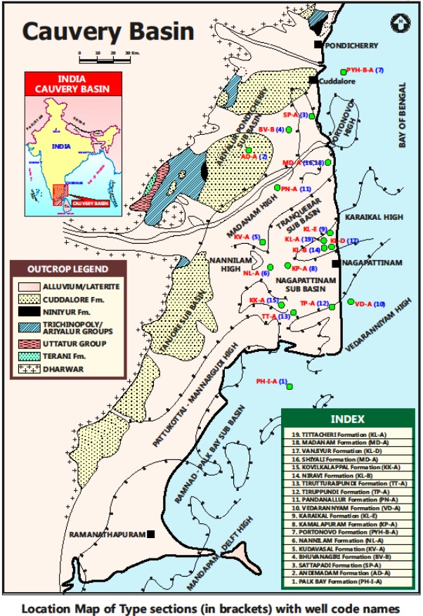
SUBSURFACE: The type section is located at exploratory well Tiruppundi-A (depth interval: 1243-630 m), in the Nagapattinam subbasin. The hypostratotype is in the well PH-C-A(depth interval: 1300-720 m). It was named after the Tiruppundi village by ONGC team led by Venkatarengan et al.(1993) and issued as Document-VII by KDMIPE, ONGC, Dehradun (1993).
[Figure 1: Type-section Map of Subsurface Formations]
Lithology and Thickness
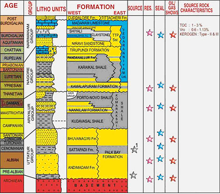
Sandy limestone. It comprises of limestone, siltstone and sandstone. Lower part represented by siltstone/sandstone with thin bands of limestone; Middle part is essentially limestone; and Upper part is marl. Limestone is gray to dirty white, flesh colored, massive and fossiliferous. Sandstone consists of thin lenses of very fine sand occurring within limestone. Its thickness varies from 580-613 m. Part of Nagora Gr.
[Figure 2: Generalized Stratigraphy and Petroleum System of Cauvery Basin (from dghindia.gov.in)]
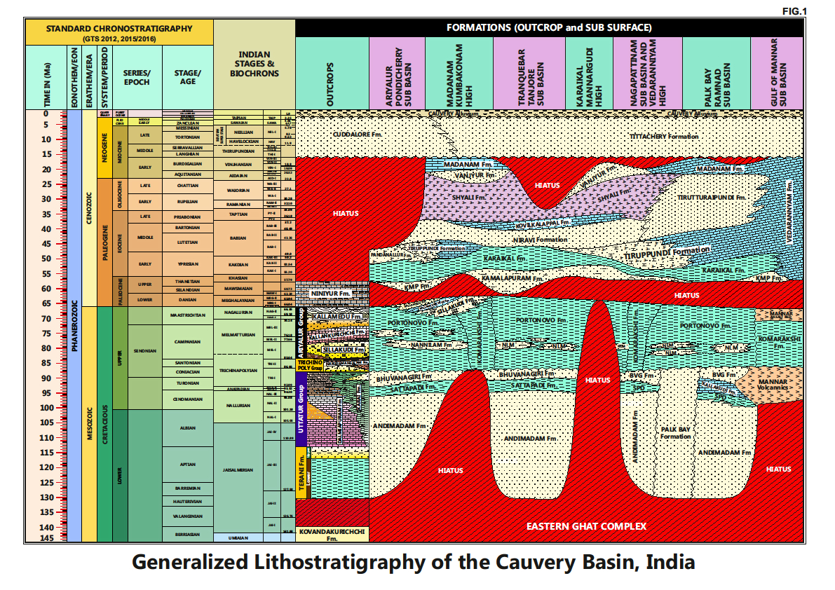
[Figure 3: Generalized Stratigraphy of Cauvery Basin (Provided by A. Nallapa Reddy & R. Nagendra)]
Relationships and Distribution
Lower contact
Unconformable with the Karaikal Fm / Pandanallur Fm.
Upper contact
Conformable with the Niravi Fm / Tirutturaipundi Fm.
Regional extent
Present in large part of the basin with three main depocenters: (1) Pondicherry SUBSURFACE, (2) Nagapattinam subbasin, and (3) south Palk Bay subbasin extending towards Mannar subbasin.
GeoJSON
Fossils
Diagnostic Foraminifera: Turborotalia cerroazulensis, Turborotalia frontosa, Acarinina broedermanni, Orbulinoides beckmanni.
Age
Depositional setting
Middle neritic-Outer neritic.
Additional Information


